
Every accurate map begins long before lines appear on a screen or paper.
Mapping is a structured process that transforms real-world observations into reliable spatial information. From field data collection to final visualization, each step plays a critical role in ensuring accuracy and usability.
- Field Data Collection
The mapping process starts in the field.
Surveyors, geospatial engineers, and analysts collect data using tools such as GPS receivers, total stations, drones, LiDAR, and remote sensing sensors.
At this stage, precision is essential. Errors in measurement, positioning, or timing can propagate through the entire workflow, affecting the quality of the final map. - Raw Data and Initial Review
Field data is often raw, fragmented, and unstructured.
Coordinates, elevations, attributes, and imagery must be checked for completeness and consistency.
This step ensures that datasets meet required standards before entering the processing phase. - Data Processing
Processing is where data becomes reliable.
Raw measurements are cleaned, corrected, georeferenced, and transformed into standardized coordinate systems.
Quality control, error correction, and data integration are crucial here. Without proper processing, even high-quality field data can lead to misleading results. - Data Visualization
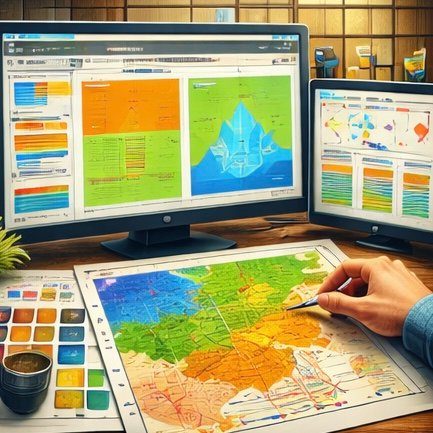
Once processed, data is prepared for visualization.
Layers, colors, symbols, and classifications are applied to translate numerical information into readable spatial patterns.
Effective visualization allows users to quickly understand relationships, trends, and spatial variations within the data. - Map Production
The final map is the result of both technical accuracy and thoughtful design.
Layout, scale, legend, and projection are carefully selected to match the map’s purpose—whether for planning, analysis, exploration, or decision-making.
A map is not just a visual output; it is a communication tool. - Maps as Decision-Making Tools
Maps guide real-world decisions.
They support infrastructure planning, environmental management, resource exploration, disaster mitigation, and policy development.
This is why every stage—from field data to final map—must be handled with scientific rigor.
Conclusion
Mapping is a journey from reality to representation.
Through systematic data collection, processing, and visualization, raw observations become meaningful spatial information.
Behind every map lies a disciplined workflow—turning data into insight.