
Every digital map we use today—whether on a smartphone, GIS platform, or decision-support system—begins far from a screen. It starts in the real world, through a structured journey of data collection, observation, processing, and interpretation. Understanding this journey helps us appreciate how reliable spatial information is created.
- Field Measurement: Capturing Reality on the Ground
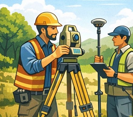
The foundation of any map lies in direct field measurement. Surveyors collect primary spatial data using tools such as GNSS receivers, total stations, and leveling instruments. These measurements establish accurate coordinates, elevations, and reference points that reflect real-world conditions.
Field data provides the ground truth—essential for ensuring accuracy and minimizing spatial errors in later stages. - Drone Mapping: High-Resolution Data from Above
Unmanned Aerial Vehicles (UAVs), commonly known as drones, bridge the gap between ground surveys and large-area mapping. By capturing high-resolution aerial imagery, drones enable detailed mapping of terrain, infrastructure, and land use.
This method is especially effective for areas that are difficult to access or require frequent updates, such as construction sites, mining areas, and disaster-prone regions. - Satellite Imagery: Observing at Regional and Global Scales
Satellite data allows mapping at broader spatial scales. Earth observation satellites continuously capture imagery covering cities, countries, and even entire continents. This data supports applications ranging from environmental monitoring and urban planning to climate analysis.
While satellite imagery may have lower resolution than drone data, its consistency and wide coverage make it indispensable. - Data Processing: Transforming Raw Data into Information
Raw spatial data cannot be used directly. It must undergo processing, including correction, georeferencing, classification, and integration. Geographic Information Systems (GIS) play a central role in organizing data layers, correcting distortions, and aligning multiple data sources.
This stage transforms scattered measurements into structured spatial information. - Map Production: Visualizing Spatial Relationships
Once processed, data is translated into maps that communicate spatial patterns and relationships. Cartographic design principles—such as scale, symbolization, and color—ensure that maps are not only accurate but also readable and meaningful.
At this stage, data becomes a visual language. - Digital Maps: Supporting Decisions in Real Time
The final output is a digital map that can be accessed, updated, and analyzed dynamically. These maps support decision-making in fields such as urban development, natural resource management, transportation, and disaster mitigation.
Modern digital maps are no longer static products—they are living systems connected to continuous data flows.
Conclusion
From field measurement to digital visualization, the journey of spatial data is a layered and systematic process. Each step adds value, accuracy, and context. Understanding this journey highlights that maps are not merely images, but carefully constructed representations of reality designed to inform decisions.