
As technology advances, one of the most fascinating developments in historical research is the use of Geographic Information Systems (GIS) not just to map the present, but to reconstruct the past. Historical GIS provides an innovative way to understand history, connecting spatial data with the key events that have shaped civilizations over time.
What is Historical GIS?
Historical GIS is the application of GIS technology to analyze and reconstruct past events, environments, and phenomena using spatial data. By integrating old maps, historical records, and archaeological findings, researchers can create interactive visualizations that reveal how places and societies have evolved.
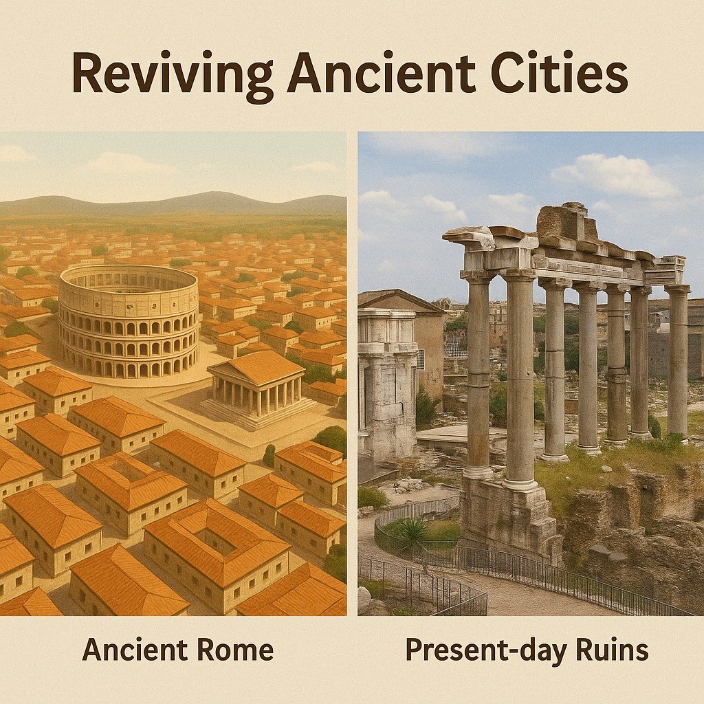
Reviving Ancient Cities
Imagine being able to walk the streets of Ancient Rome as it once was. Through Historical GIS, archaeologists and historians can bring ancient cities back to life by merging excavation data, historical documents, and vintage maps to digitally recreate cityscapes in three dimensions. This approach not only makes history more tangible but also deepens our understanding of ancient social, political, and economic systems.
Analyzing the World Wars
Beyond ancient history, GIS has become an essential tool in the study of more recent events, such as the World Wars. By digitizing military documents, aerial photographs, and battlefield maps, researchers can trace troop movements, analyze strategic decisions, and explore logistical patterns. What once required imagination can now be studied with spatial precision, providing new insights into military history.
Tracing Ancient Trade Routes
The world’s historic trade networks—such as the Silk Road and spice shipping lanes—can also be reconstructed using GIS. By combining records of ancient ports, travel routes, and archaeological discoveries, scholars can visualize how goods, ideas, and cultures were exchanged across continents. These spatial reconstructions shed light on global connections that shaped the modern world.
How Does Historical GIS Work?
The process starts with gathering historical data from documents, old maps, and archaeological notes. This information is then digitized and entered into GIS software, where it can be mapped and analyzed. The result is a set of interactive visualizations, making it easier for researchers, students, and the public to explore and understand the past.
Why Does Historical GIS Matter?
Historical GIS has a wide range of benefits. It transforms static, text-based history into an interactive experience that is easier to comprehend. By making the past accessible and engaging, Historical GIS supports academic research, cultural preservation, and educational innovation.
Conclusion: Where Technology Meets History
Historical GIS is a powerful example of how technology and history can work together, offering new perspectives on our past and fresh insights for the future. By viewing history through a spatial lens, we not only learn about what came before us—we also gain a deeper understanding that can help guide us forward.