
In sectors such as mining, forestry, and infrastructure, projects do not operate in abstract space. They exist within clearly defined physical, legal, and environmental boundaries. A map, therefore, is not merely a supporting document—it is a fundamental tool for planning, risk management, and accountability.
Mapping as the Foundation of Project Boundaries
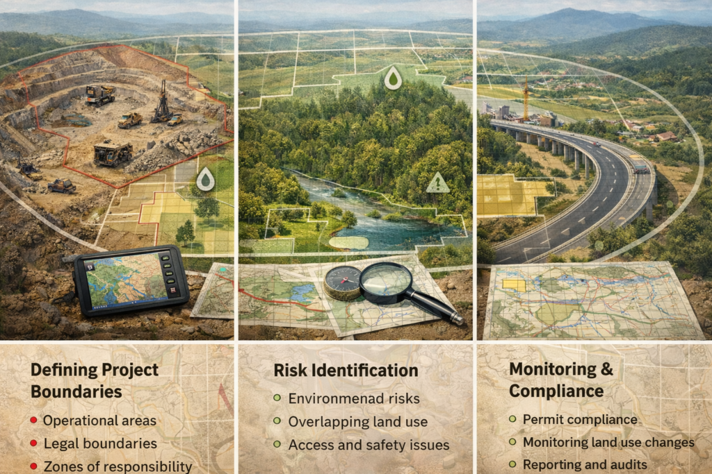
Every project begins with space. Maps define where activities are permitted, where they are restricted, and where responsibilities begin and end. In regulated industries, unclear boundaries can lead to land disputes, regulatory violations, and operational delays. A well-prepared map transforms assumptions into measurable limits.
Identifying and Managing Spatial Risks
Many project risks are spatial in nature. Environmental sensitivity, overlapping land use, access constraints, and safety hazards are often invisible without spatial analysis. Maps allow project teams to visualize these risks early, enabling informed decisions before issues escalate into costly problems.
Supporting Planning and Operational Efficiency
Effective planning relies on understanding terrain, distance, and spatial relationships. Maps support site layout design, logistics planning, and resource allocation. By integrating spatial data, project managers can optimize operations while minimizing unnecessary environmental and financial costs.
Ensuring Compliance and Monitoring
In mining, forestry, and infrastructure development, compliance does not end with permit approval. Ongoing monitoring is required to ensure activities remain within authorized areas. Maps serve as a reference point for audits, reporting, and long-term oversight, helping organizations demonstrate transparency and regulatory compliance.
Maps as Decision-Making Tools
Beyond visualization, maps function as analytical frameworks. They integrate data, reveal patterns, and support strategic decisions across the project lifecycle. When spatial understanding is embedded into management processes, projects become more predictable, controllable, and sustainable.
Conclusion
A map is not simply a technical requirement or visual aid. It is a critical instrument that connects planning, risk management, and governance.
A project without a map is a risk without control.