
Topographic maps have evolved significantly beyond traditional contour lines on paper. Today, advanced technologies enable us to generate high-resolution elevation data that support various applications, from disaster risk reduction to land-use planning. Three key tools driving this progress are LiDAR, drones, and satellite radar.
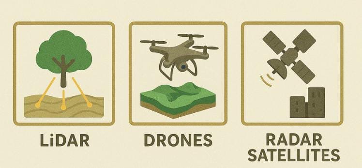
- LiDAR: Laser Precision from the Air
LiDAR (Light Detection and Ranging) works by sending pulses of laser light from a sensor, typically mounted on an aircraft, toward the Earth’s surface. These pulses penetrate vegetation and reflect off ground surfaces, allowing for accurate 3D models even in dense forested areas. LiDAR is widely used in forestry, archaeology, and terrain modeling due to its ability to distinguish between canopy, understory, and ground levels. It is especially valuable in identifying micro-topographic features that may not be visible with other methods.
- Drones: Flexible and On-Demand Mapping
Unmanned Aerial Vehicles (UAVs), or drones, equipped with photogrammetry tools or LiDAR payloads, have revolutionized the way we collect topographic data. Drones allow for rapid surveys over specific areas with high spatial resolution. They are particularly useful in monitoring construction sites, landslides, mining activities, and small-scale environmental changes. The advantage of drone mapping lies in its flexibility, relatively low cost, and ability to be deployed frequently for time-series analysis.
- Satellite Radar: Seeing Through Clouds and Time
Synthetic Aperture Radar (SAR) mounted on satellites such as Sentinel-1 enables us to detect subtle land movements and elevation changes—even through cloud cover or at night. Unlike optical imagery, radar can capture surface deformation such as subsidence, landslides, or tectonic shifts over time. This makes radar a powerful tool for large-scale monitoring across entire regions. When combined with ground truth data, it provides essential insights for urban planning, natural disaster preparedness, and environmental protection.
Why It Matters
High-quality topographic data informs better decisions. Whether it’s managing flood risks, guiding reforestation efforts, or assessing mining impacts, accurate elevation models help policymakers, scientists, and local communities understand the terrain and act accordingly.
Final Thoughts
LiDAR, drones, and satellite radar each have unique strengths. When integrated, they offer a comprehensive toolkit for mapping the Earth’s surface with precision and depth. As these technologies become more accessible, the future of topographic analysis is not just more accurate—but more inclusive, transparent, and impactful.