
The digital age has transformed nearly every aspect of our lives, and the way we view and interact with the world around us is no exception. Gone are the days when we relied on static paper maps to navigate unknown streets. Today, we live in a world where maps are interactive, dynamic, and capable of providing real-time updates, all at the touch of a button. Welcome to the world of WebGIS—where geography meets technology.
The Evolution of Maps: From Paper to Digital
The Traditional Map: Limited and Static
For centuries, maps have been our primary tool for navigation. Whether it was a paper road map, a world atlas, or a hand-drawn sketch, these tools provided a static, one-dimensional view of the world. While incredibly useful, paper maps had their limitations. They couldn’t update automatically, required constant interpretation, and, most notably, could not reflect real-time changes like traffic, weather, or other dynamic conditions.
Enter Interactive Maps: The Future of Navigation
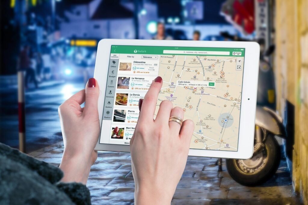
In contrast, interactive maps today offer so much more than just a simple location guide. With the advent of digital technologies, we now have access to live, constantly updating maps that provide insights into everything from traffic conditions to weather patterns, and even natural disaster data. These interactive maps are powered by WebGIS (Web-based Geographic Information Systems), which enable real-time updates, detailed data overlays, and even predictive analysis.
What Is WebGIS?
At its core, WebGIS refers to a web-based Geographic Information System that allows users to view, interact with, and analyze geographical data through a digital map interface. Unlike traditional paper maps, WebGIS offers interactive features like zooming, panning, and real-time updates—making it a powerful tool for individuals and organizations alike.
Some key features of WebGIS include:
- Real-time Data Integration: WebGIS can display real-time data such as weather patterns, traffic conditions, and emergency alerts.
- Interactive Analysis: Users can zoom in to specific locations, click on map features for detailed data, and even overlay multiple datasets for better decision-making.
- Customizable and User-Friendly: WebGIS can be tailored for specific applications, whether for urban planning, disaster management, or business analytics.
How WebGIS is Transforming the Way We Use Maps
- Navigation and Route Planning
One of the most widely used applications of WebGIS is in navigation. Whether you’re using Google Maps, Waze, or Apple Maps, you’re relying on WebGIS technology. These tools not only provide turn-by-turn directions but also incorporate real-time traffic data to suggest the fastest routes, estimate arrival times, and even reroute you in case of congestion. - Disaster Management and Public Safety
In the face of natural disasters, WebGIS can be a lifesaver. For example, during a flood, WebGIS can provide real-time data on water levels, identify safe evacuation routes, and locate emergency shelters. Similarly, during wildfires, WebGIS can track fire progression, air quality, and evacuation zones. - Urban Planning and Smart Cities
WebGIS plays a crucial role in the development of smart cities. City planners use WebGIS to analyze traffic patterns, identify potential areas for development, and plan the layout of transportation systems. These maps also help in assessing environmental conditions, making cities more sustainable and responsive to the needs of their residents. - Environmental and Public Health Monitoring
Beyond city planning, WebGIS has been instrumental in monitoring environmental changes. For instance, scientists use it to track deforestation, climate change, and endangered species. In the field of public health, WebGIS can map out disease outbreaks, such as tracking the spread of epidemics or identifying high-risk areas for certain illnesses.
Everyday Use of WebGIS: You’ve Probably Used It Already
Without even realizing it, many of us already use WebGIS technology in our daily lives. Here are a few examples:
- Google Maps and Waze: These navigation tools rely on WebGIS to provide real-time traffic information, route recommendations, and live updates on accidents or roadblocks.
- Weather Apps: Whether it’s checking the weather or tracking a hurricane, WebGIS allows apps to provide up-to-date forecasts and storm tracking.
- Delivery Services: Apps like Uber Eats or Postmates utilize WebGIS to optimize delivery routes and track packages in real time.
The Future of Interactive Maps
As technology continues to evolve, the potential for WebGIS is vast. Imagine being able to create your own personalized map of your favorite places to visit, restaurants to try, or a map dedicated to your next travel adventure—all interactive and updated in real time. The possibilities are limitless.
Creating Your Own Interactive Map
Thanks to platforms like ArcGIS Online, Google Earth Engine, and Mapbox, anyone with a basic understanding of geospatial data can start building their own maps. Whether you’re a business owner mapping out customer locations, or a researcher tracking environmental changes, WebGIS opens the door to a wealth of data visualization and spatial analysis tools.
Conclusion: The Power of WebGIS at Your Fingertips
From navigation to disaster management, urban planning to environmental monitoring, WebGIS has revolutionized how we interact with the world around us. As technology continues to advance, interactive maps will only become more intuitive, more detailed, and more integral to our everyday lives.
If you could create your own interactive map, what would it look like? What data would you choose to map out? The future of mapping is in your hands, and the possibilities are endless.