
When people hear the word drone, most imagine a small quadcopter hovering in place. However, not all drones are built to hover. In professional mapping and surveying, a different category dominates large-scale operations: fixed-wing drones.
Yes — they are real, widely used, and highly specialized.
What Is a Fixed-Wing Drone?
A fixed-wing drone is an unmanned aerial vehicle (UAV) designed with airplane-style wings. Instead of generating lift through spinning propellers like multirotors, it relies on forward motion and aerodynamic lift from its wings.
Because of this design, fixed-wing drones:
Cannot hover
Must continuously move forward
Require space for takeoff and landing (unless hybrid VTOL)
This configuration makes them structurally and operationally closer to aircraft than to consumer drones.
Why Are They Used in Professional Projects?
Fixed-wing drones are built for efficiency and coverage.
Compared to multirotor drones, they offer:
Longer flight endurance (often 60–120 minutes)
Larger area coverage per mission
Higher operational efficiency for expansive terrain
Reduced battery swaps and flight repetition
For projects covering hundreds or thousands of hectares, this efficiency directly translates into lower operational cost and reduced field time.
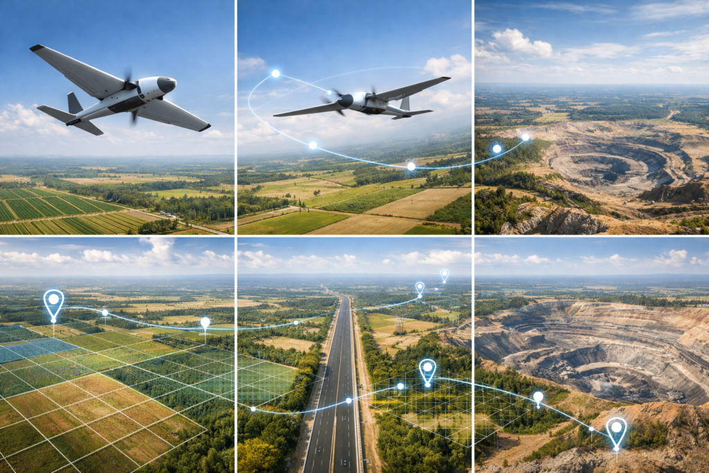
Common Industry Applications
Fixed-wing drones are widely used in:
- Large-Scale Topographic Mapping
Capturing geospatial data over extensive land areas. - Mining Operations
Monitoring pit progression, stockpile volumes, and haul road development. - Corridor Mapping
Surveying long linear infrastructure such as:
Highways
Pipelines
Railways
Transmission lines - Agricultural Monitoring
Assessing crop health across large plantations.
Real-World Examples
Several commercially available fixed-wing drones include:
senseFly eBee series
Quantum Systems Trinity series
Delair UX11
Trimble UX5
These platforms are used globally by surveyors, mining companies, engineering consultants, and government agencies.
Limitations to Consider
Despite their advantages, fixed-wing drones are not suitable for every situation.
Limitations include:
Inability to hover for detailed inspection
Requirement of open takeoff/landing areas
Less maneuverability in confined environments
For dense urban inspections or vertical structure analysis, multirotor drones remain more practical.
Fixed-Wing vs. Multirotor: A Strategic Choice
The selection between fixed-wing and multirotor is not about which is better — but which is appropriate for the operational objective.
If the priority is:
Wide coverage
Efficiency over distance
Long-duration mapping
Fixed-wing drones are the strategic choice.
If the priority is:
Hover capability
Close inspection
Confined spaces
Multirotors are more suitable.
Conclusion
Fixed-wing drones are not conceptual or experimental — they are established, field-proven tools in professional surveying and geospatial industries.
Their aerodynamic design enables longer endurance, broader coverage, and cost efficiency in large-area projects. While they lack hovering capability, their operational advantage in extensive land mapping makes them indispensable in sectors such as mining, infrastructure, and agriculture.
In large-scale operations, distance is not a limitation — it is where fixed-wing drones perform best.