
PlanetScope is an innovative satellite constellation that plays a crucial role in monitoring our planet. In this blog, we will explore what PlanetScope is, how it works, and the benefits it offers for various sectors.
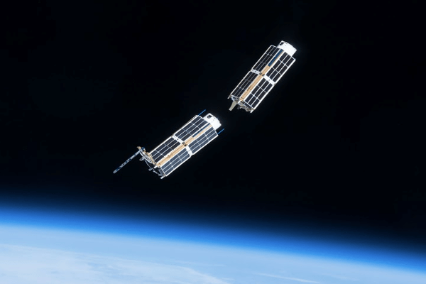
Number of Satellites: 430+ Dove and SuperDove 🚀
PlanetScope consists of over 430 small satellites known as Dove and SuperDove. These satellites are designed to work together in a constellation, allowing for efficient and rapid Earth imaging. With such a large number, PlanetScope can cover nearly the entire surface of the Earth every day. This extensive coverage ensures that we have access to timely and relevant data about our planet.
Purpose: To Capture Daily Images of Earth 📸
The primary goal of PlanetScope is to provide accurate and up-to-date images of the Earth every day. This capability assists various sectors, from scientific research to environmental monitoring, in obtaining real-time data. The images produced enable better analysis and more informed decision-making. Whether it’s tracking changes in land use or monitoring natural disasters, PlanetScope plays a vital role in understanding our world.
Benefits: 🌱
- Environmental Monitoring
Data from PlanetScope is used to monitor environmental changes, such as deforestation, pollution, and the impacts of climate change. With this information, we can take steps to protect our ecosystems and promote sustainability. - Sustainable Agriculture
Farmers utilize images from PlanetScope to monitor crop health, optimize water usage, and improve yields. This data aids in making better decisions for sustainable farming practices, ensuring food security for future generations. - Scientific Research
Researchers in various fields, including geography, ecology, and climate change, leverage PlanetScope data for in-depth analysis. The images produced provide new insights into Earth’s dynamics and the changes occurring, contributing to our understanding of complex environmental issues.
How It Works: 🛰️
- Satellites Orbiting Earth
The PlanetScope satellites orbit the Earth at specific altitudes, allowing them to capture images from various angles. This orbital design ensures comprehensive coverage of the planet. - Capturing High-Resolution Images
Each satellite is equipped with advanced sensors that can capture images with high resolution, providing exceptional detail about the Earth’s surface. This level of detail is crucial for accurate analysis and monitoring. - Sending Data to Analysis Centers
After images are captured, the data is sent to analysis centers for processing and evaluation. The results are then made available to users worldwide, enabling timely access to critical information.
Conclusion: 🌟
PlanetScope is a vital tool in Earth monitoring that provides accurate and up-to-date data. With the ability to capture images daily, PlanetScope helps us understand the changes occurring on our planet and make better decisions for the future. By leveraging satellite technology, we can work together to protect the environment and ensure the sustainability of natural resources.