
Accurate mapping is essential in various fields, including construction, land development, environmental studies, and urban planning. The right tools can make a significant difference in the precision and efficiency of surveying tasks. In this blog post, we will explore some of the most important surveying tools that help professionals achieve accurate results.
The Importance of Accurate Mapping 📏
Mapping is not just about creating a visual representation of an area; it involves collecting data that can influence critical decisions. Whether you are planning a new building, assessing land for agricultural use, or conducting environmental research, accurate data is crucial. The tools used in surveying play a vital role in ensuring that the information gathered is reliable and precise.
Main Surveying Tools 🛠️
- GPS (Global Positioning System) 📍
GPS technology has revolutionized the way we determine locations. This tool uses satellites to provide accurate positioning data, allowing surveyors to pinpoint exact locations on the Earth’s surface. With high accuracy, GPS is essential for tasks such as land surveying, mapping, and navigation. It is particularly useful in large areas where traditional surveying methods may be time-consuming. - Total Station 📏
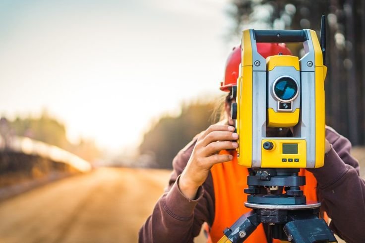
A total station is a sophisticated instrument that combines a theodolite and an electronic distance measuring device. This tool allows surveyors to measure both horizontal and vertical angles, as well as distances, with high precision. Total stations are widely used in construction and civil engineering projects, where accuracy is paramount. They can also store data electronically, making it easier to analyze and share information. - Drones 🚁
Drones have become increasingly popular in surveying due to their ability to capture aerial imagery and data quickly and efficiently. Equipped with high-resolution cameras and sensors, drones can create detailed maps and 3D models of landscapes. They are particularly useful for surveying large or hard-to-reach areas, providing a unique perspective that traditional methods cannot achieve. Drones also reduce the time and labor required for data collection.
Additional Surveying Tools 🧰
- Theodolite 🔭
The theodolite is a classic surveying instrument used to measure angles in both horizontal and vertical planes. While it may not be as advanced as some modern tools, it remains a reliable option for many surveyors. Theodolites are often used in conjunction with other tools to ensure accurate measurements, especially in construction and land surveying. - Water Level 🌊
A water level is a simple yet effective tool used to determine the level of the ground. It consists of a long tube filled with water, which allows surveyors to establish a level reference point over long distances. This tool is particularly useful in construction projects where leveling is critical, such as laying foundations or installing drainage systems. - Compass 🧭
The compass is one of the oldest surveying tools still in use today. It helps surveyors determine direction and orientation, making it an essential tool for navigation and mapping. While modern technology has introduced more advanced tools, the compass remains a reliable backup for establishing bearings and directions in the field.
Conclusion 🎯
In the world of surveying, having the right tools is crucial for achieving accurate and reliable results. From GPS and total stations to drones and traditional instruments like the theodolite and compass, each tool plays a unique role in the surveying process. As technology continues to evolve, the capabilities of these tools will only improve, making surveying more efficient and precise.
Call to Action 💬
What’s your favorite surveying tool? Have you had any interesting experiences using these tools in your projects? Share your thoughts in the comments below! And don’t forget to follow our blog for more exciting content about mapping and surveying technology.