
Topographic maps are essential tools for anyone interested in geography, outdoor activities, or land use planning. They provide a detailed representation of the Earth’s surface, showcasing various features that help us understand the terrain. In this blog post, we will explore the key components of topographic maps and their significance.
What is a Topographic Map?
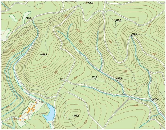
A topographic map is a detailed and accurate representation of the Earth’s surface, illustrating the contours, elevation, and various natural and man-made features. These maps are invaluable for hikers, geologists, urban planners, and anyone who needs to navigate or understand the landscape.
- Contour Lines
One of the most distinctive features of topographic maps is contour lines. These lines connect points of equal elevation, allowing us to visualize the shape of the land. The spacing of the contour lines indicates the steepness of the slope: when the lines are close together, the terrain is steep; when they are spaced further apart, the slope is gentle. Understanding contour lines is crucial for anyone planning to hike or build in a particular area. - Symbols and Legend
Topographic maps use a variety of symbols to represent different features, such as roads, buildings, and vegetation. Each map comes with a legend that explains what each symbol means. Familiarizing yourself with these symbols is essential for interpreting the map accurately and navigating effectively. - Map Scale
The scale of a topographic map indicates the relationship between distances on the map and actual distances on the ground. For example, a scale of 1:24,000 means that one inch on the map represents 24,000 inches in reality. Understanding the scale is vital for estimating distances and planning routes. - Natural Features
Topographic maps also highlight various natural features, including rivers, lakes, forests, and mountains. These features are not only important for navigation but also for understanding the ecology and geography of an area. For outdoor enthusiasts, knowing where these features are located can enhance the experience of exploring nature.
Conclusion
Topographic maps are powerful tools that help us understand and navigate the world around us. By familiarizing ourselves with their components—contour lines, symbols, scale, and natural features—we can better appreciate the complexity of our landscapes. Whether you’re an avid hiker, a student of geography, or a professional planner, mastering the use of topographic maps can greatly enhance your understanding of the terrain.