
Landsat 8 satellite imagery has become an invaluable tool in the fields of remote sensing and environmental analysis. With its ability to capture detailed images of the Earth’s surface, Landsat 8 plays a crucial role in monitoring various environmental changes. In this blog post, we will delve into the advantages and disadvantages of Landsat 8, as well as its applications, particularly in the context of a study conducted in Gresik Regency, Indonesia.
What is Landsat 8? 🤔
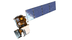
Landsat 8 is part of the Landsat program, which has been providing continuous satellite imagery of the Earth since the early 1970s. Launched in 2013, Landsat 8 features advanced sensors that capture images with a spatial resolution of 30 meters. This level of detail allows researchers and decision-makers to analyze land use changes, vegetation patterns, and land surface temperatures effectively.
Advantages of Landsat 8 Satellite Imagery 🌟
- High Spatial Resolution:
One of the standout features of Landsat 8 is its high spatial resolution of 30 meters. This allows for detailed monitoring of environmental changes, making it an excellent choice for studies that require precise data. - Wide Data Availability:
Landsat 8 boasts an extensive archive of data, enabling users to access historical and current imagery from various locations around the globe. This wide availability is particularly beneficial for researchers looking to analyze long-term environmental trends. - Relatively Low Cost:
Compared to other high-resolution satellite imagery options, Landsat 8 is relatively affordable. This accessibility allows a diverse range of stakeholders—including government agencies, academic institutions, and non-governmental organizations—to utilize the data for their research and projects.
Disadvantages of Landsat 8 Satellite Imagery ⚠️
- Dependence on Weather Conditions: One of the limitations of Landsat 8 is its susceptibility to weather conditions. Cloud cover, fog, and other atmospheric factors can obscure the imagery, affecting the quality and clarity of the data. This can be particularly challenging for analyses that require clear images.
- Limitations in Monitoring Environmental Changes:
While Landsat 8 is a powerful tool, it has limitations in detecting very small or rapid changes in the environment. As a result, researchers often need to complement Landsat 8 data with other methods, such as higher-resolution satellite imagery or additional remote sensing techniques.
Application in Gresik Regency 🌴
A notable application of Landsat 8 imagery can be seen in a study conducted in Gresik Regency, Indonesia. In this research, Landsat 8 was utilized to analyze changes in vegetation density index, land surface temperature, and air quality index. The findings demonstrated that Landsat 8 is effective in monitoring environmental changes and can significantly support decision-making processes in natural resource management and environmental protection.
Conclusion 📚
Landsat 8 satellite imagery is an essential resource in the realm of remote sensing and environmental analysis. Its high resolution, wide data availability, and affordability make it a preferred choice for many researchers and decision-makers. However, it is crucial to acknowledge its limitations, such as dependence on weather conditions and challenges in monitoring small changes. By using Landsat 8 in conjunction with other methods, researchers can achieve more accurate and comprehensive results.
As we continue to explore the capabilities of satellite imagery, Landsat 8 remains a vital tool for understanding and managing our planet’s resources and environment. Whether you are a researcher, policymaker, or simply an enthusiast of Earth observation, Landsat 8 offers a wealth of information that can help us better understand the changes occurring on our planet.